Capitol Reef National Park
Located at south-central Utah
In south central Utah, Capitol Reef National Park is located and it is a United States of America National Park. This park is narrow but long and it covers almost 100 miles; and the Capitol Reef National Park was first established in 1971. There is almost 241,904 acres of land which preserves the park; and the park is going to be opened throughout the entire year. However, the months of May, June, July, August and September are going to be the months which are the most popular.
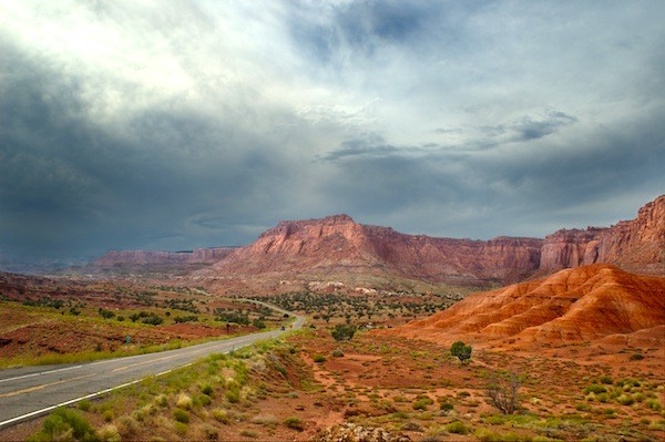
In the 1920’s, the park was called Wayne Wonderland, this was the name given by the locals Joseph S Hickman and Ephraim Pectol. However, the Capitol Reed National Park does have many amazing monoliths, buttes, canyons and ridges that are home in the canyon; and there is a 75 mile stretch of a long thrust called the Waterpocket Fold. This is a beautiful spine which comes from the Thousand Lake Mountain through to Lake Powell; and this is the most protected and preserved parks of the park also.
This area is near the Fremont River and it was named because of the line of cliffs and white domes from the Navajo Sandstone. This area does look like the American States Capitol building; and the easy road access was helped along with the construction of State Route 24 in 1962 which went through Fremont River Canyon.
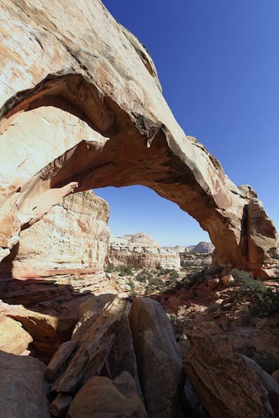
There aren’t many paved roads which invade the beautiful landscape and in fact most of the park’s back country and trails are left undisturbed. There are many amazing sites to choose from including the arches and towers and the park does have a very desert feel to it. The scenic drives are going to allow the visitors to see some of the very scenery to choose from; and a lot of the scenery is going to be very close to the main high way also. There are beautiful trails and unpaved roads which stretch hundreds of miles.
The History of the Mormons and Native American Settlers
Over the years, there were Mormons and Native American settlers that came to the capitol reef park. It is thought that the Native Americans lives near the Fremont River to the north of the National Park thousands of years ago. They were thought to grow crops of maize, lentils and squash which were stored in granaries – their grains were; and in the 13th century, the culture of the Native Americans changed. This may have been because of the very lengthy drought the area had and soon after the settlers from the Fremont Settlements and fields were left – abandoned really by all settlers.
In 1872, Alan H Thompson explored the area of the Waterpocket Fold; this was closely followed by Clarence Dutton who studied the area and its geology for many years. The Water pocket fold was not explored to a lengthy extent but it was an amazing area because it was very rugged as it is today. However, once the American Civil War was over, the Mormon missionaries moved to the area. This was in 1870’s and new settlers moved to the area.
The Mormon missionaries settled at the Fremont River Valley and established Fruita. During the early part of the 20th century, lime was extracted; this came from uranium and limestone. It was in 1904 when the first uranium mine was established in the area. There was a lot of hard work going in Fruita however, over the years, the land changed suddenly and the park was isolated once more.
It was in 1921 when the first effects to protect the land. There was money raised over time to help protect and restore parts of the park; and during the 30’s very little money was raised for the park. However in 1937, President Roosevelt signed a bill that created the Capitol Reef National Monument; this happened on the 2nd of August. The park covered 37,711 acres and when the depression rolled around the park suffered from funds.
Torrey in Utah is the closest town to Capitol Reef National Park as the town lies only 8 miles away from the park. It’s just west of the park, from the visitors centre and the town is quite small also. However, there are many great restaurants and motels to stay at for those who wish to visit the park or who want to stay overnight.
Inside the park, there is a very large camp ground which can be used by the visitors. Though for anyone who wishes to use this, it can be filled up very quickly, mostly by the early afternoon. This usually happens in the summer time and at most weekends also. Though, even if visitors don’t get into the camp grounds, the nearby town is still a great location to stay at.
Overnight camping inside the park is going to require a permit; visitors are going to be able to gain this permit from the rangers at the visitors centre. Don’t worry, its simple to get! There is however a very popular area in which many use, the Burr Trail Scenic Back way is great and this is going to allow visitors to gain access to the Grand Staircase Escalante National Monument to the town of Boulder.
There orchards were planted by the Mormon pioneers who came to the area and today the orchards are still there at the park. However, they are maintained by the National Park Service; for a small fee, visitors can harvest their own fruits as there are many different fruits which grow in the orchards. Though this is quite fun to do and something that many love to try out.
There are many different activities in the park to choose from including horseback riding, a driving tour as well as hiking; however mountain biking is not allowed inside the park. However, there are options for those who wish to go mountain biking with a few trails which are just outside the park for visitors.

